Along road 122 between Panevėžys and Rokiškis, in a quiet corner of what is actually a pretty quite country you will stumble on an interesting UNESCO world heritage site.
To be honest it isn’t particularly impressive, a small inscribed stone column, a white fence surrounding a little hole in the ground, a faded and hard to read signboard and a wooden walkway with some triangles on the ground.
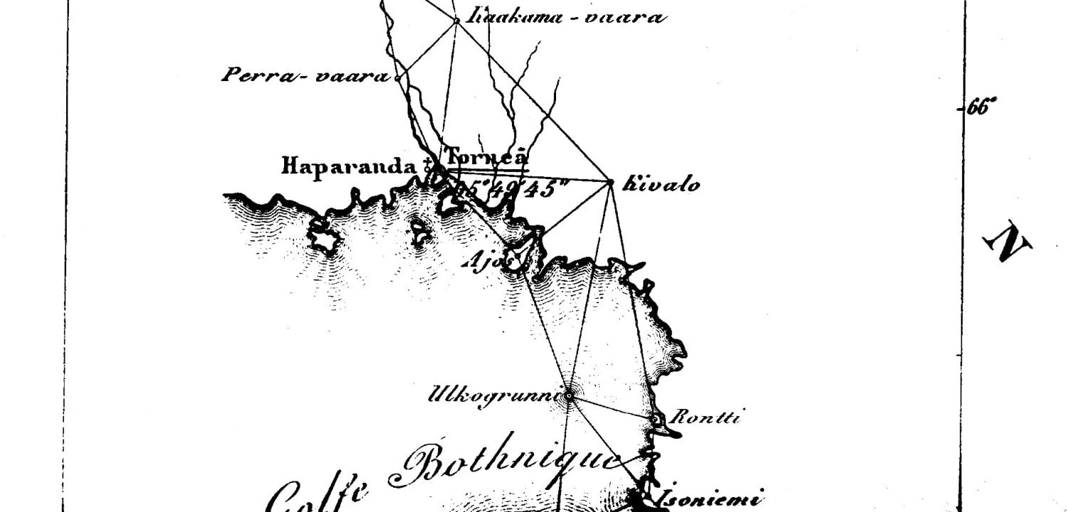
As low key as that might sound, this is actually a pretty important place. It is one of the remaining 34 markers on the Struve Geodetic Arc, a line stretching for more than 2800 km across 10 countries, from Hammerfest in Norway to Stara Nekrasivka in Ukraine.
I didn’t know what a geodetic arc is and had never heard of Friedrich Georg Wilhelm von Struve until I did a little bit of research and discovered a bit more about the way that we measure the size and shape of the world.
Now we can throw up a network of satellites and use them to measure the distance between a couple of points on the earth’s surface. We kind of forget just how much work and ingenuity such a (modernly simple) task took a couple of centuries ago.
It took 39 years for Struve and his team of scientists to measure the world. Starting in 1816 from the Dorpat Observatory in Estonia (which was part of Russia at the time), they used 256 measuring points to triangulate a line stretching from the North Sea to the Danube. When they finished the task in 1855, they had created the first accurate measurement of a meridian and could precisely calculate the exact shape and size of the earth for the first time, it was a massive scientific advance.
The most amazing thing about this achievement to me, is not that the arc is such a scientific marvel, but that it is a symbol of what can be accomplished by cooperation. To measure this meridian arc wasn’t the work of one man, it took the collaboration and working together to scientists from different countries over a period of almost 40 years and also the agreement and collaboration of the monarchs of those different countries.
We live in a world where it seems that we are becoming more fragmented, where countries are leaving historic unions, where many people see the US president as promoting xenophobia and racism, where paranoia seems to run rife through governments and populations and where we inch closer to a potential new nuclear arms race. Maybe we need to look at achievements like this arc more often and realise just how much more we can achieve together than in opposition to each other.
So, this unimposing little hole in the ground is actually part of something pretty amazing. If you happen to be driving along that road then stop and check it out, or if you feel like seeing a more impressive monument to the arc then maybe visit the Old Observatory in Tartu, Estonia or take a journey far north to Hammerfest, one of the most northern towns in the world, where a plaque reads:
‘The northernmost end of a geodetic arc at 25° 20′ from the northern ocean to the Danube river – through Norway, Sweden and Russia. On the instructions of HM Oscar I and Emperors Alexander I and Nicolaus I, using unbroken geometries. Latitude: 70° 40′ 11.3″.‘
Good job Friedrich!